 Catálogo de Metadados Geográficos
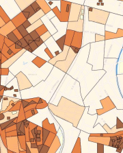
Densidade demográfica 2022 (hab/ha)
Mapa temático produzido a partir dos setores censitários e da população relativos ao censo 2022. É o resultado da divisão do total de habitantes pela área territorial.
IBGE/DPE/GTD - Gerência Técnica do Censo Demográfico e SMUL.
Simple
- Date (Revision)
- 2026-03-06
Cited responsible party
Point of contact
Point of contact
- Maintenance and update frequency
- As needed
- Theme
-
-
Sociedade
-
População
-
Características gerais da população
-
- Access constraints
- semRestricoes
- Use constraints
- License
- Classification
- Unclassified
- Spatial representation type
- Vector
- Denominator
- 100000
- Topic category
-
- Society
))
- Reference system identifier
- SIRGAS2000 / UTM zone 23S (EPSG:31983)
Spatial representation info
- Topology level
- Full surface graph
- Geometric object type
- Surface
- Distribution format
-
-
Postgis - OGC
(
9.3
)
-
Postgis - OGC
(
9.3
)
- OnLine resource
- GeoSampa ( WWW:LINK-1.0-http--link )
- OnLine resource
- WFS ( WWW:LINK-1.0-http--link )
- OnLine resource
- WMS ( WWW:LINK-1.0-http--link )
- OnLine resource
-
densidade_demografica
(
OGC:WMS-1.3.0-http-get-capabilities
)
Recomenda-se a utilização do navegador Microsoft Edge para a visualização desse link.
- Hierarchy level
- Dataset
- Statement
-
Descrição: Vetorização em tela; Mapa temático
Forma de atualização: Forma de atualização: Atualização manual e pontual, por emissão de OS.
Os dados referentes a 2010 encontram-se disponíveis para download.
Link para SEI 6068.2024/0002637-2:
- File identifier
- 75b0f795-c31c-4e3c-a1b8-5875e9ef3ae9 XML
- Metadata language
- Portuguese
- Character set
- UTF8
- Hierarchy level
- Dataset
- Date stamp
- 2026-03-06T16:10:39
- Metadata standard name
-
ISO 19115:2003/19139
- Metadata standard version
-
1.0
Overviews

Spatial extent
Provided by
