 Catálogo de Metadados Geográficos
Correios
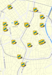
Identificação dos pontos georreferenciados das agências de atendimento dos CORREIOS.
Simple
- Date (Publication)
- 2018-08-31
- Date (Revision)
- 2020-05-25
- Status
- Completed
- Maintenance and update frequency
- As needed
- Date of next update
- 2020-05-25
- Theme
-
-
Ambiente Construído
-
Energia e comunicação
-
- Access constraints
- semRestricoes
- Use constraints
- License
- Classification
- Unclassified
- Spatial representation type
- Vector
- Denominator
- 5000
- Character set
- UTF8
- Topic category
-
- Society
N
S
E
W
))
- Reference system identifier
- EPSG / SIRGAS2000 / UTM zone 23S (EPSG:31983) / 8.5
- Topology level
- Full planar graph
- Geometric object type
- Point
- Distribution format
-
-
Postgis - OGC
(
9.3
)
-
(
)
-
Postgis - OGC
(
9.3
)
- OnLine resource
- Geosampa ( WWW:LINK-1.0-http--link )
- Hierarchy level
- Dataset
- Statement
-
Vetorização em tela. Pontos georreferenciados obtidos pelo endereçamento dos postos de atendimento descritos no site da empresa.
- File identifier
- 04d7b7bc-b986-4f94-9a78-5488f6008cfc XML
- Character set
- UTF8
- Date stamp
- 2025-03-18T23:27:23
Overviews
thumbnail

large_thumbnail
Spatial extent
N
S
E
W
Provided by

Associated resources
Not available