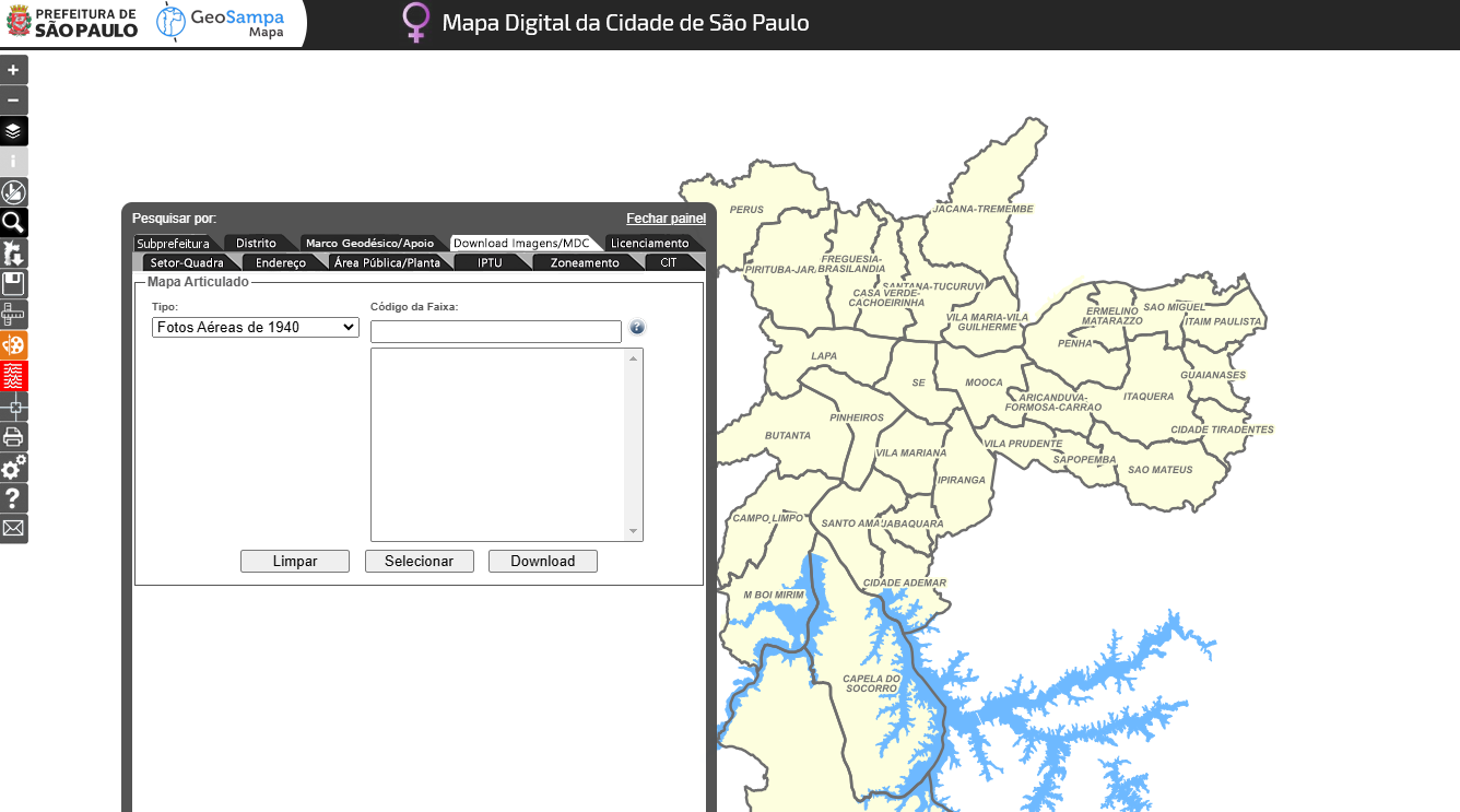
Fotos Aéreas de 1940 (Arquivos para Download)
Fotos do Levantamento aerofotogramétrico da Cidade de São Paulo, 1940 (cobertura parcial). Altura do vôo: 2.690m (ref. nivel do mar).
Estes arquivos estão disponibilizados para download. Para realizar o download, clicar na ferramenta "Pesquisar" (lupa) e aba Download Imagens/MDC.O download poderá ser realizado inserindo o código da faixa ou selecionando no mapa a área de interesse.
Uma foto aérea é uma fotografia, a qual foi obtida por meio da utilização de uma câmera rigorosamente calibrada, com distância focal e demais parâmetros conhecidos. A foto aérea possui uma projeção cônica e pode passar por uma série de tratamentos fotogramétricos.
Simple
- Date (criation)
- 2001-12-01
- Date (Publication)
- 2014-12
- Status
- Completed
- Maintenance and update frequency
- Not planned
- Keywords
-
-
Meio físico
-
Imageamento
-
- Access constraints
- semRestricoes
- Use constraints
- License
- Classification
- Unclassified
- Spatial representation type
- Grid
- Denominator
- 20000
- Topic category
-
- Imagery base maps earth cover
))
- Reference system identifier
- / Não se aplica /
Spatial representation info
- Distribution format
-
- OnLine resource
- GeoSampa ( WWW:LINK-1.0-http--link )
- OnLine resource
- Saiba mais em: ( WWW:LINK-1.0-http--link )
- OnLine resource
- WFS ( WWW:LINK-1.0-http--link )
- OnLine resource
- WMS ( WWW:LINK-1.0-http--link )
- OnLine resource
- Articulação de Imagens das Fotos Aéreas de 1940 ( WWW:LINK-1.0-http--link )
- Hierarchy level
- Dataset
- Statement
-
Dados cartográficos;
Descrição: Vetorização em tela;
Forma de atualização: Manual, atualização pontual, por emissão de OS.
- File identifier
- 49028231-cc98-4b58-9608-0f8c45abbe43 XML
- Character set
- UTF8
- Date stamp
- 2025-03-05T15:57:27
Overviews


Spatial extent
))
Provided by

 Catálogo de Metadados Geográficos