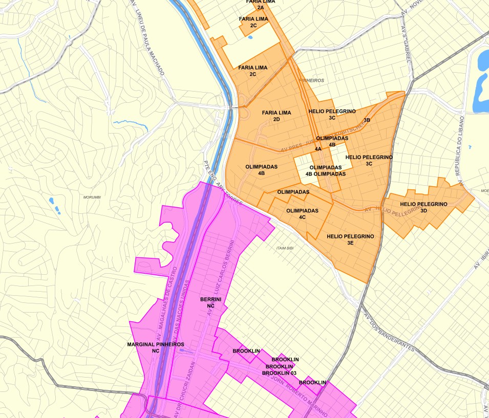
Setores / subsetores da Operação Urbana
Subdivisões dos perímetros da Operações Urbanas com regramentos urbanísticos específicos.
As Operações Urbanas são um conjunto de intervenções coordenadas pelo Poder Público Municipal, com a participação de proprietários, moradores, usuários e investidores privados, com o objetivo de alcançar em uma determinada área transformações urbanísticas estruturais, melhorias sociais e a valorização ambiental. Cada Operação Urbana (OU) deve ser aprovada por lei municipal específica, tendo seu perímetro previamente definido.
Na presente camada são apresentados os setores ou subsetores das seguintes Operações Urbanas:
- Operação Urbana Centro – Lei nº 12.349/1997 e alterações (Revogada)
- Operação Urbana Consorciada Faria Lima – Lei nº 13.769/2004 e alterações
- Operação Urbana Consorciada Água Espraiada – Lei nº 13.260/2001 e alterações
- Operação Urbana Consorciada Água Branca – Lei nº 15.893/2013 e alterações
Simple
- Date (criation)
- 2015-05-20
- Date (Revision)
- 2025-05-16
- Maintenance and update frequency
- Not planned
- Keywords
-
-
ambiente construído
-
planejamento urbano
-
intervenções urbanísticas
-
- Access constraints
- semRestricoes
- Use constraints
- License
- Classification
- Unclassified
- Spatial representation type
- Vector
- Denominator
- 2000
- Topic category
-
- Planning cadastre
))
- Reference system identifier
- SIRGAS2000 / UTM zone 23S (EPSG:31983)
- Distribution format
-
-
Postgis - OGC
(
9.3
)
-
Postgis - OGC
(
9.3
)
- OnLine resource
- GeoSampa ( WWW:LINK-1.0-http--link )
- OnLine resource
- Operações Urbanas ( WWW:LINK-1.0-http--link )
- OnLine resource
- Operações Urbanas - SMUL ( WWW:LINK-1.0-http--link )
- OnLine resource
- WMS ( null )
- OnLine resource
- WFS ( null )
- OnLine resource
-
operacao_urbana
(
OGC:WMS-1.3.0-http-get-capabilities
)
Recomenda-se a utilização do navegador Microsoft Edge para a visualização desse link
- Hierarchy level
- Dataset
- Statement
-
Descrição: Vetorização em tela;
Forma de atualização: Manual: Atualização pontual, por emissão de OS;
Arquivo para gestão interna PMSP: Link SEI 6068.2024/0013823-5 - https://sei.prefeitura.sp.gov.br/sei/controlador.php?acao=procedimento_trabalhar&id_procedimento=125121784
- File identifier
- c811e59b-5820-4491-a19d-3bc37527a4fa XML
- Metadata language
- Portuguese
- Character set
- UTF8
- Hierarchy level
- Dataset
- Date stamp
- 2025-06-13T12:47:02
- Metadata standard name
-
ISO 19115:2003/19139
- Metadata standard version
-
1.0
Overviews

Spatial extent
))
Provided by

 Catálogo de Metadados Geográficos