 Catálogo de Metadados Geográficos
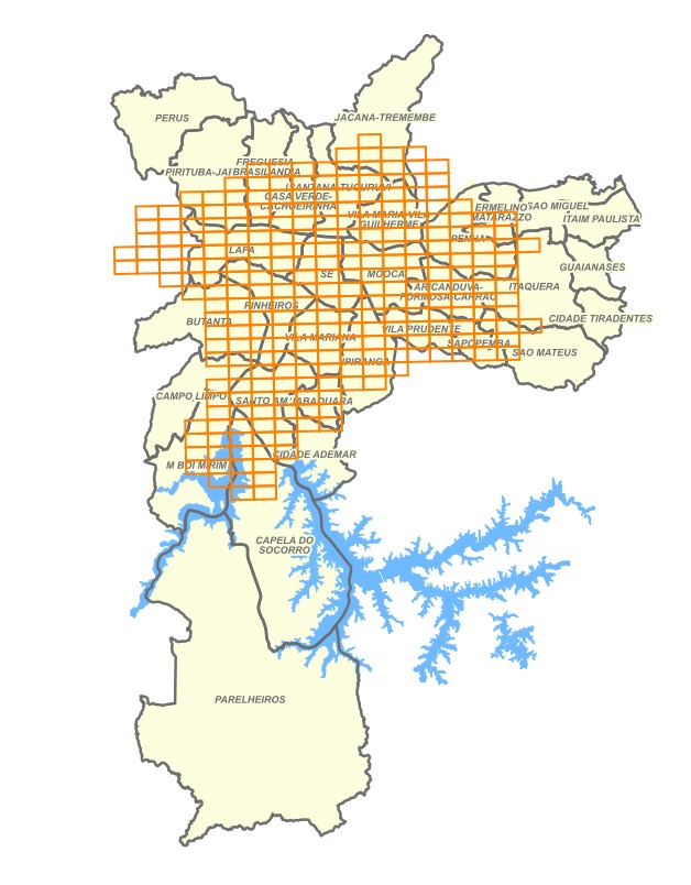
Índice da VASP Cruzeiro em 1954
Índice de restituição cartográfica do Levantamento Aerofotogramétrico executado por VASP aerofotogrametria S/A e Serviços Aerofogramétricos Cruzeiro do Sul S/A em 1954.
Arquivo vetorial com o limite das restituições cartográficas do levantamento aerofotogramétrico, permitindo visualizar e identificar o conjunto restituído.
Simple
- Date (criation)
- 1954-01-01
- Date (Publication)
- 2014-12-01
- Maintenance and update frequency
- Not planned
- Keywords
-
-
Meio Físico
-
Imageamento
-
- Access constraints
- semRestricoes
- Use constraints
- License
- Classification
- Unclassified
- Spatial representation type
- Vector
- Denominator
- 2000
- Topic category
-
- Imagery base maps earth cover
))
- Reference system identifier
- SIRGAS2000 / UTM zone 23S (EPSG:31983)
- Distribution format
-
-
Postgis - OGC
(
9.3
)
-
Postgis - OGC
(
9.3
)
- OnLine resource
-
GeoSampa
(
WWW:LINK-1.0-http--link
)
Sistema de Consulta do Mapa Digital da Cidade de São Paulo
- OnLine resource
- WFS ( WWW:LINK-1.0-http--link )
- OnLine resource
- WMS ( WWW:LINK-1.0-http--link )
- OnLine resource
-
quadricula_vasp_cruzeiro
(
OGC:WMS-1.3.0-http-get-capabilities
)
Recomenda-se a utilização do navegador Microsoft Edge para a visualização desse link.
- OnLine resource
- Metadados de VASP Cruzeiro em 1954 (Arquivos para Download) ( WWW:LINK-1.0-http--link )
- OnLine resource
- Metadados do Mapeamento 1954 - Vasp Cruzeiro ( WWW:LINK-1.0-http--link )
- Hierarchy level
- Dataset
- Statement
-
Dados cartográficos
Vetorização em tela.
Índice do levantamento aerofotogramétrico da Cidade de São Paulo, completado pelo consórcio VASP Aerofotogrametria S/A e Serviços Fotogramétricos Cruzeiro do Sul S/A. Área de abrangência de 569 quilômetros quadrados, na escala de 1:2.000, e 1.493 quilômetros quadrados, nas escalas de 1:10.000, 1:25.000 e 1:40.000.
Forma de atualização: Manual: Atualização pontual, por emissão de OS.
- File identifier
- f238c838-b856-403d-a88f-0f178916f7e8 XML
- Metadata language
- Portuguese
- Character set
- UTF8
- Hierarchy level
- Dataset
- Date stamp
- 2025-05-07T18:17:41
- Metadata standard name
-
ISO 19115:2003/19139
- Metadata standard version
-
1.0
Overviews
Spatial extent
Provided by
